


Select Your 4x4 to See Compatible Products
- Fender Flares
- Long Range Fuel Tanks
- Mirrors
- Performance
- Tray & Lids
- Towbars
- Roof Racks
- Roof-Boxes
- Roof Rack Accessories & Spare Parts
- Roof Trays
- Safeguard
- Sports and Leisure
- Storage & Luggage
- Trade & Work Solutions
- Torsion Bars
- Steering
- Sway Bar Links
- Accessories
- Shocks
- Adjustable Trailing Arms
- Panhard Rods
- Shackles
- U Bolts
- Upper Control Arms
- Bushes
- Leaf Springs
- Coils
- Load Plus
- Strut Tops
- Tyre Repair & Maintenance
- Compressor
- Recover
- Winches
- Audio
- Communications
- Dual Battery Systems
- Lighting
- Interior Fridge Slides
- Seat Covers
- Storage
- Brackets and Mounts
- Vehicle Protection
- Bullbars
- Rear Protection Bar
- Bedding
- Hema Maps
- Camp Accessories
- First Aid
- Fridge & Freezers
- Camp Lighting & Power
- Camp Furniture
- Awnings
- Tent

Premium Navigation Solutions for Australian Exploration
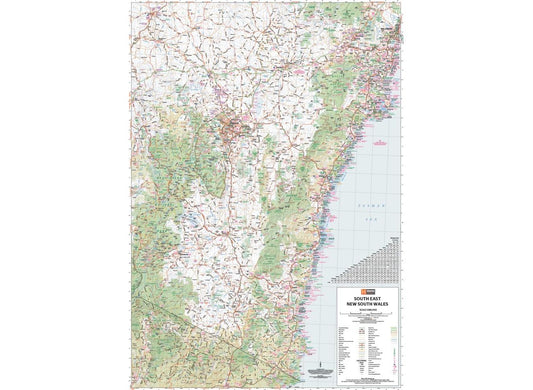
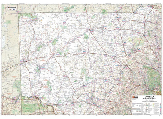
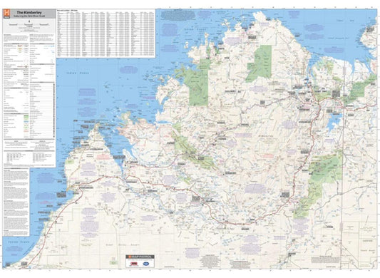
The Hema Australia Large Map delivers comprehensive coverage for planning extended journeys across our vast continent. This iconic map showcases major road networks, outback fuel distances, and national parks on durable, high-quality paper that withstands harsh conditions. The visual appeal makes it perfect for both practical navigation and as an educational tool, with the reverse side featuring an overview of Australia's iconic touring regions including history, geology, and bucket-list attractions.
Professional installation of the Hema On/Off Road Nav Module seamlessly integrates with compatible multimedia receivers, delivering both precise turn-by-turn guidance and comprehensive off-road navigation. This powerful module combines HERE Technologies' road navigation with HemaX Digital's award-winning off-road maps, providing access to over 100,000 moderated points of interest. The built-in GPS ensures accurate location tracking even without mobile coverage, making it ideal for remote Australian adventures.
- Comprehensive coverage of major road networks and distances
- Outback fuel locations clearly marked for remote travel planning
- National parks and Aboriginal lands clearly identified
- Distance grid and detailed index for quick reference
- Integration with compatible multimedia systems for seamless operation
Quality camp accessories enhance your mapping experience, especially when exploring remote areas. Portable lighting solutions allow for evening map reading, while durable storage options protect your maps from the elements. When paired with reliable Navigation Systems, these accessories ensure you're prepared for any journey, whether following established tracks or creating your own adventure. The right combination of maps and camping gear transforms challenging terrain into an accessible playground for exploration.
Advanced Safety and Regional Mapping Technology
Safety becomes paramount when venturing into remote areas, which is why we supply and install the Hema WIFI Reversing Camera. This IP69K-rated camera offers protection against dust and high-pressure water, providing clear rearward visibility to minimize blind zone accidents. The camera features a 150-degree wide-angle field of view for comprehensive coverage and built-in Wi-Fi connectivity for direct transmission to your navigator.
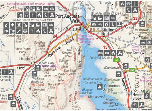
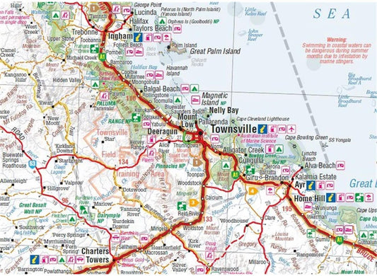
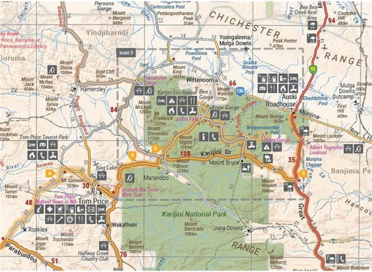
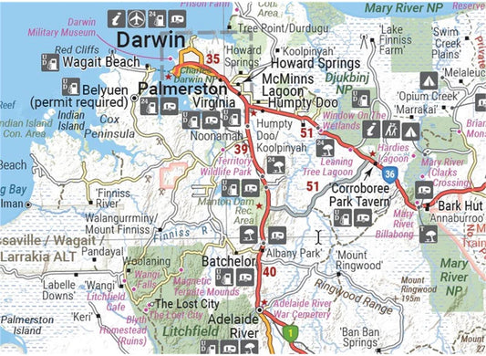
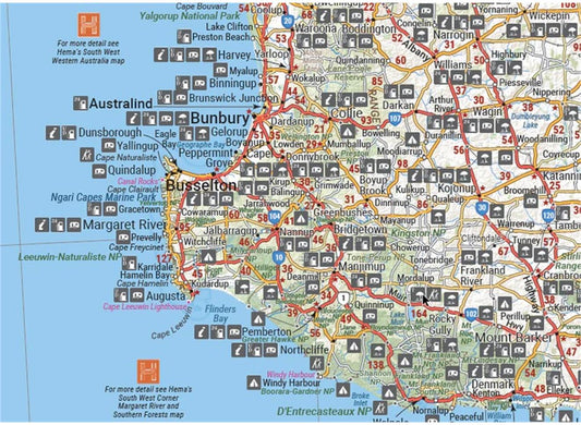
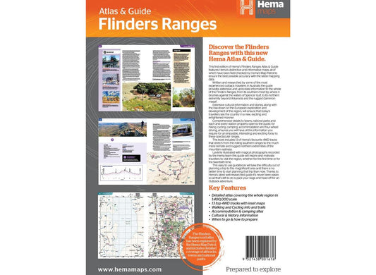
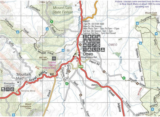
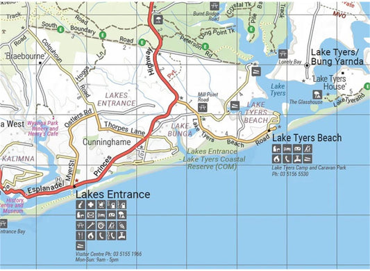
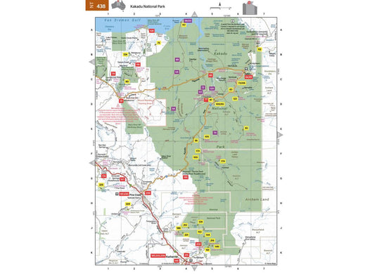
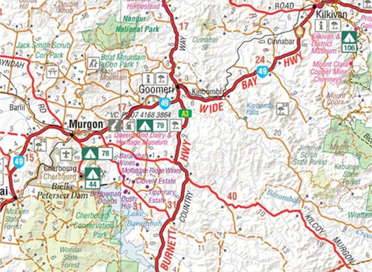
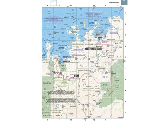
Regional expertise drives our selection of specialized maps including the Great Desert Tracks Central, Flinders Ranges Map, Pilbara Map, and Coral Coast Map. These field-checked maps highlight crucial 4WD tracks, distance markers, and topographical relief for specific regions. The Great Desert Tracks Central covers from Judbarra/Gregory National Park in the north to Ceduna in the south, featuring key routes like the Oodnadatta Track and Tanami Road. The Coral Coast Map showcases diverse marine attractions around Shark Bay and Ningaloo Reef while covering inland highlights like Karijini's gorges.
- Wireless range up to 70 metres for camera transmission
- Quick power-on time of just 1.0 second for immediate visibility
- Waterproof mapping with GPS surveyed roads and tracks
- Detailed coverage of fuel stops, camping areas, and historic sites
- Comprehensive inset maps for enhanced navigation detail
Essential camp accessories support your navigation setup during extended stays in these remote regions. Quality sleeping gear, cooking equipment, and lighting solutions ensure comfort while following your mapped routes. Digital Mapping technology combined with proper camp accessories creates a complete travel solution for discovering Australia's most spectacular landscapes, from the red centre to coastal paradises.


