.jpg)


Your Shopping Cart Is Empty
You have no items in your shopping cart.
Let's go buy something!
You have no items in your shopping cart.
Let's go buy something!

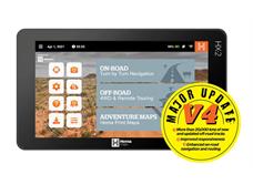
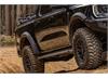
The ultimate on and off-road GPS navigation system, combining dedicated street and 4WD navigation to guide you anywhere in Australia. Featuring Australia’s best topographic mapping, turn-by-turn navigation and over 40,000 campsites, caravan parks and other touring points of interest in a 7-inch multi-touch screen, it’s time to explore a new frontier with the HX-2.
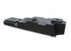
Hema’s Wi-Fi reversing camera used in conjunction with the Hema HX-2 Navigator offers enhanced rearward visibility for drivers and, thus, help minimise the risk of “blind zone” accidents whenever your vehicle is moving in reverse.
This wireless backup camera helps you easily spot vehicles, pedestrians, pets and other hard-to-see obstructions behind your vehicle.
Suitable for both 12v and 24v vehicles (camera and transmitter are compatible from 9 to 28 Volts).
The camera is IP69K rated providing protection against ingress of dust and high temperature, high pressure water.
Key FeaturesHeavy duty glass mount with 85mm suction area, adjustable angle and reach. This mount allows a Hema HX-2 Navigator to be mounted to the windscreen of a vehicle or any glass surface (plastic suction cap attachment).
Please note: this windscreen mount is also included when you purchase an HX-2 Windscreen Mount (included in the HX-2 box)
The Hema Navigator Sun Visor is designed to fit Hema’s 7 inch GPS Navigators (including the HX-2, HX-1 and HN7).
The Sun Visor can help to reduce glare from the sun and easily attaches to the GPS unit using two rubber-coated springs.
Key FeaturesWhether it’s for a local camping weekend, an overseas travel holiday, an interstate road trip or an epic 4WD adventure, HEMA have got countless books, atlases, and guides to help you plan and navigate your next trip.
Come down to our showroom and check out the range of Hema maps for Australia and overseas!
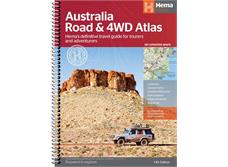
Featuring trusted Hema mapping for all of Australia, the Hema Road & 4WD Touring Atlas is the definitive travel guide for tourers and adventurers. Hema atlases feature more information useful to travellers, including 4WD tracks, campsites, caravan parks, rest areas, 24-hour fuel and points of interest.
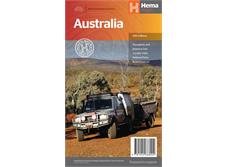
This Hema map Australia edition contains more mapping than ever before, which is enhanced by a striking new cartographic style that’s incredibly easy to read. Included in this is up-to-date mapping for Australia’s biggest 4WD destinations: Cape York, Fraser Island, the Top End, the Kimberley, the Pilbara, Central Australia, High Country Victoria and the Flinders Ranges.
Key FeaturesThis first edition of Hema’s Flinders Ranges Atlas & Guide features Hema’s distinctive and informative maps, all of which have been field checked by Hema’s Map Patrol to ensure the best possible accuracy with the latest mapping data.
Written and researched by some of the most experienced outback travellers in Australia (including industry doyen, Ron Moon), the guide provides extensive and up-to-date information for the whole of the Flinders Ranges, from its southernmost tip, where it brushes against the waters of the Spencer Gulf, to its northern extremity beyond Arkaroola and the rugged Gammon massif.
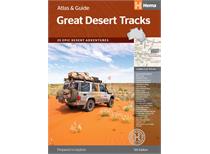
Key FeaturesFor over 20 years, Hema Map Patrol has been mapping the interior of Australia. In this comprehensive guide to traversing Australia’s desert regions, Hema takes you into the arid heart of Australia. Whether you are a desert lover, or just looking to tackle some of Australia’s favourite 4WD destinations, this informative guide is an indispensable companion to those tackling Australia’s great desert tracks. This edition includes handy track profiles showing elevations and distances as well as points of interest, camping areas and supply points in one easy-to-follow graphic. There’s also plenty of essential pre-trip reading on how to prepare for your trek, safety in the outback and driving techniques, making this the must-have guidebook for travelling Australia’s deserts.
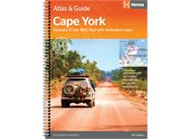
Key FeaturesHema Maps’ Cape York Atlas & Guide helps you make the most of your visit to this remarkable part of Australia.
With detailed coverage of The Tip, the coast from Cairns to Cooktown, Rinyirru (Lakefield) National Park, the Peninsula Developmental Road, Old Telegraph Track, Torres Strait and the Savannah Way, it ensures you won’t miss the ‘must-see’ attractions, but it also describes some of the lesser known areas favoured by the experts. Whether you just want to make it to The Tip or are looking for a serious 4WD adventure, this informative book is an indispensable companion.
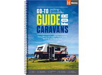
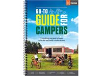
Key FeaturesHema’s Go-To-Guide for Caravans was the first release in Hema’s ‘Go-To’ series which contains Go-To guides for Motorhomes, Campers, 4WDs and Boats. This guide was produced in collaboration with Australia’s longest-running and industry-leading magazine Caravan World.
This publication is an informative introductory guide for those who plan on using a Caravan to travel around Australia.
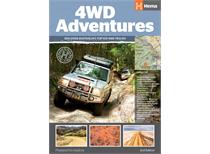
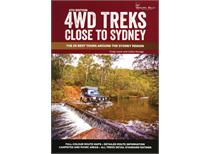
Key FeaturesDiscover Australia’s Top 100 4WD tracks using this guide as your ultimate off-road adventure tool. Each page features colourful, glossy imagery and detailed tracks personally mapped out and driven by the Hema Map Patrol and our team of experts, for the most up-to-date information across 19 different regions of Australia. With the 4WD Adventures guide, you can expect to have a reliable source of knowledge at your fingertips, turning your 4WD trip into a reality.
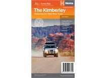
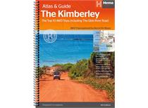
Key FeaturesThe definitive guidebook for exploring Western Australia’s Kimberley region, featuring the Top 10 4WD Trips written by Ron and Viv Moon, in combination with topographic atlas mapping for the region.
This edition of Hema’s best-selling outdoor guidebook for discovering the Kimberley now features 20 atlas pages in a stunning new cartographic style. The guide now features the Top 10 4WD Trips for the Kimberley, which has been written by off-road legends Ron and Viv Moon. Also included is an introduction to the region, as well as information sections on planning the trip and what to see and do. There are detailed touring sections on the distinct regions of the Kimberley. The Top 10 4WD Trips are broken into their respective localities, with each trip containing comprehensive trip information including gradings, distances, relevant travel information and drive coverage from start to finish.
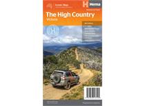
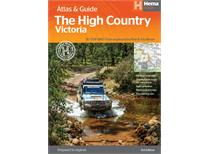
Key FeaturesThis edition of Hema’s best-selling outdoor guidebook for discovering the Victorian High Country now features 40 atlas pages at a large scale of 1:150 000 in a stunning new cartographic style. The guide now features the Top 30 4WD Trips for the High Country, which has been written by off-road legends Ron and Viv Moon. Also included is an introduction to the region, as well as information sections on planning the trip and what to see and do. There are detailed touring sections on the distinct regions of the High Country, including the Great Alpine Road, Alpine National Park as well as Snowy River and Baw Baw national parks. The Top 30 4WD Trips are broken into their respective localities, with each trip containing comprehensive trip information including gradings, distances, relevant travel information and drive coverage from start to finish.
Key FeaturesTravel maps are the perfect trip planning and navigation tool, and our online shop stocks all kinds of travel maps: topographic and touring Hema maps of Australia, as well as city maps, street maps and road maps, country maps and worldwide maps.
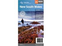
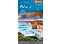
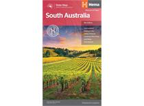
The Hema Maps range of state maps features full size state maps and handy maps for New South Wales, Northern Territory, Queensland South Australia, Tasmania, Victoria and Western Australia. The maps are top quality reference guides with the trademark Hema Map cartography style and the rich points of interest collected by the Map Patrol.
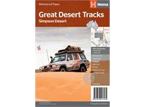
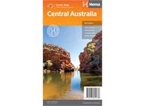
The Hema Maps range of regional maps features iconic destinations including Cape York, Flinders Ranges, Great Desert Tracks and the Kimberley. The maps are top quality touring companions with the trademark Hema Map cartography style and the rich points of interest collected by the Map Patrol.
With a range of wall maps on offer to help plan your next adventure, Hema maps of Australia are marked with major road networks, Outback fuel, distances and major national parks, which in combination with the map’s visual appeal make it perfect as either a trip planner, a decorative map, or an educational tool.
Want to buy a detailed and reliable Hema map of Australia? Call Truracks Western Towbars & Bullbars today on (02) 4731 4680 or contact us online.